Hiking in Chimborazo offers something few other high-altitude destinations in the world can: accessible routes for all experience levels, less than an hour from a town with hotels, restaurants, and all amenities. You don't need to be a mountaineer or have technical equipment to hike among vicuñas at 4,800 meters above sea level with Ecuador's highest volcano looming above you.
But hiking in Chimborazo also has routes for those looking for more: high mountain trails that reach the second refuge at 5,000 meters above sea level, crossings through the Cubillines moorland, hikes towards the El Altar Volcano and alternative access routes from indigenous communities that few guides mention.
This guide organizes all hiking options in Chimborazo by level, with real data on distance, time and difficulty so that each traveler can choose the right route.
Why hiking in Chimborazo is unique in Ecuador
Hiking in Chimborazo combines three factors not found together in any other destination in Ecuador. The first is the altitude: hiking at 4,800 meters above sea level at the point on Earth farthest from the planet's center is an experience that transcends any mountain trail at lower altitudes.
The second is the wildlife: the vicuñas that live freely in the Chimborazo Wildlife Production Reserve are the most unexpected encounter on a hike in Chimborazo. They move in herds through the high-altitude grasslands around the first refuge and approach hikers within a few meters with a surprising naturalness.
The third is logistical accessibility. Hiking on Chimborazo can be done in a day from Riobamba, without the need for camping or a multi-day expedition. Hacienda Abraspungo is 50 minutes from the volcano and coordinates transfers for those who don't want to drive on the mountain road.
Hiking routes in Chimborazo by level
These are the hiking routes in Chimborazo, organized from the most accessible to the most technical. Each one has its own difficulty profile, time requirements, and qualifications.
Level 1 — Easy: Parking to Carrel Shelter
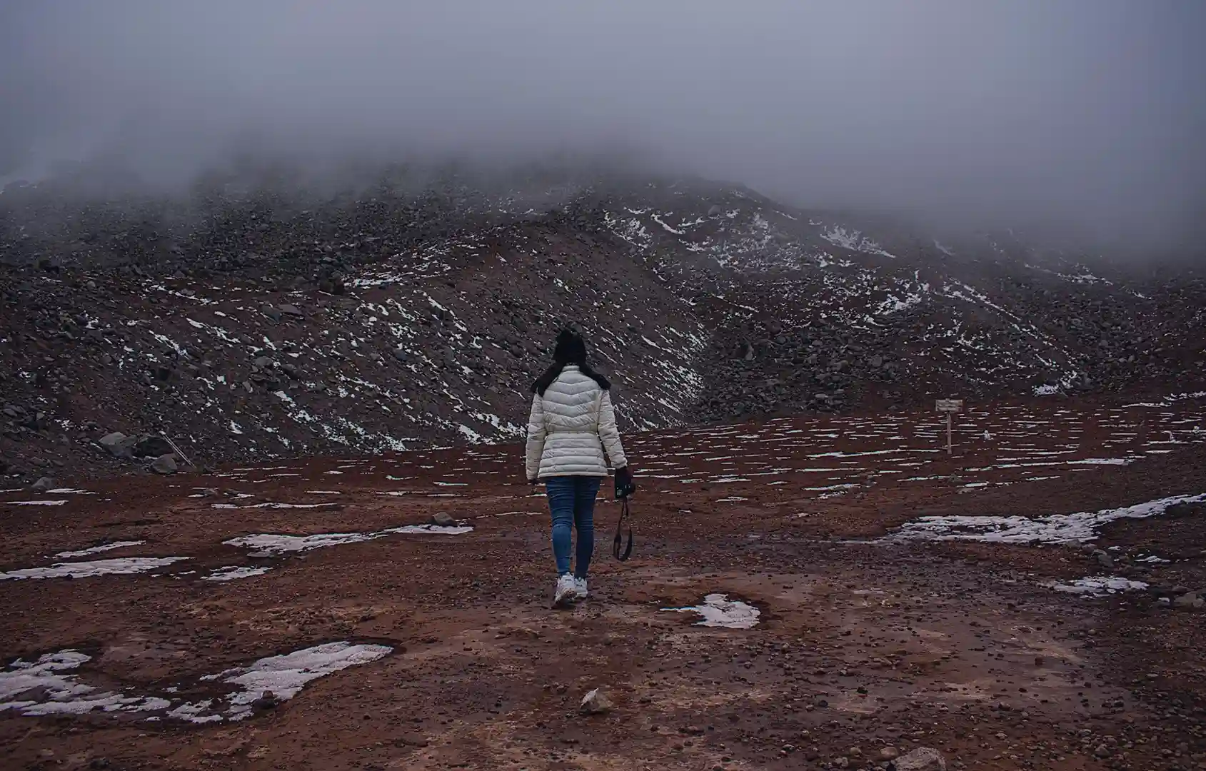
It is the most accessible and most visited hiking route in Chimborazo. The trail runs from the main parking lot of the Reserve to the Carrel Refuge, at 4,800 meters above sea level.
| Detail | Fact |
|---|---|
| Distance | 1.2 km (one way) |
| Duration | 45 minutes to 1 hour (one way) |
| Level difference | +200 meters |
| Difficulty | Low difficulty — suitable for families with children over 8 years old |
| Requires guidance | No |
| Entrance fee | $2 for domestic residents / $6 for foreigners |
The terrain is volcanic rock with a well-marked trail. The main challenge is altitude sickness—walking slowly, breathing deeply, and avoiding sudden movements are key. The refuge has a cafeteria, restrooms, and direct views of the glacier. It's the ideal starting point for hiking on Chimborazo without prior experience.
Level 2 — Moderate: Carrel Shelter to Whymper Shelter
The second leg of the hike on Chimborazo climbs from Refugio Carrel to Refugio Whymper, at 5,000 meters above sea level. It is a more demanding route that requires better physical condition and, preferably, prior acclimatization of at least one night in Riobamba.
| Detail | Fact |
|---|---|
| Distance | 3 km from the Carrel Refuge (one way) |
| Duration | 1.5 to 2 hours from Carrel |
| Level difference | +200 additional meters |
| Difficulty | Moderate — steep slope, less oxygen |
| Requires guidance | Not mandatory, but recommended |
In the upper sections of this hiking route on Chimborazo, the terrain changes: less loose rock and more compact snow along the edges of the trail, especially in the morning. It's the usual starting point for groups attempting the summit. For those not aiming for that goal, reaching Whymper and seeing the glaciers up close is a reward that justifies the effort.
Level 3 — Moderate: Four Corners Route to Carrel Refuge
This is one of the lesser-known but more interesting alternative hiking routes in Chimborazo for those seeking something different from the standard access. The starting point is the community of Cuatro Esquinas, in the Pulingui parish, 30 minutes from Riobamba on the road to Guaranda.
The trail crosses open moorland with panoramic views of Chimborazo from angles not visible from the main access. There is a greater chance of encountering Andean condors along this route than on the standard trail—the hot air currents rising up this flank of the volcano are frequented by these birds.
| Detail | Fact |
|---|---|
| Distance | 8 to 10 km (one way) |
| Duration | 4 to 5 hours (one way) |
| Level difference | +600 meters |
| Difficulty | Moderate-high — less marked trail |
| Requires guidance | Yes — trail not always marked |
This hiking route in Chimborazo requires a local guide due to sections where the trail is not clearly marked. Guides and transportation for this hike can be arranged in advance from Hacienda Abraspungo.
Level 4 — Advanced: Crossing the Cubillines
Los Cubillines are the group of volcanic hills in the south of the province of Chimborazo — a hiking destination in Chimborazo less visited than the main volcano but equally impressive for those seeking nature without crowds.
The Cubillines trails traverse high-altitude moorlands with volcanic lagoons, open views of Chimborazo volcano, and native wildlife. Access requires a vehicle to the starting point—from Hacienda Abraspungo, transportation is included in the guided horseback riding tours, which can also be done on foot for those who prefer trekking.
| Detail | Fact |
|---|---|
| Distance | Variable depending on the chosen route |
| Duration | 3 to 6 hours |
| Level difference | Variable |
| Difficulty | Moderate-high — uneven moorland terrain |
| Requires guidance | Yeah |
Level 5 — Expedition: Ascent to the summit of Chimborazo
The ascent to the summit of Chimborazo, at 6,268 meters above sea level, is a high-altitude expedition beyond the scope of conventional hiking on the mountain. It requires full technical glacier equipment, a certified high-mountain guide, a minimum of three days of acclimatization, and prior glacier experience.
For climbers at this level, Chimborazo is one of the most sought-after technical ascents in the Ecuadorian Andes. The climb typically departs at midnight from the Whymper Refuge to reach the summit at dawn. For climbers of this level, consult directly with mountaineering agencies specializing in this type of climb in Riobamba.
What to bring for hiking in Chimborazo
The list varies depending on the level of the route, but there are basic elements that apply to any hike in Chimborazo:
- Layered outerwear: temperatures in the moor can change rapidly. Ideally, you should wear three layers: a thermal base layer, a fleece mid-layer, and an outer waterproof jacket.
- Trekking boots: sturdy sole with good grip for volcanic rock terrain. Essential for any level of hiking on Chimborazo.
- Hat, gloves, and sunglasses: UV radiation at 4,800 meters above sea level is high even on cloudy days. Quality sunglasses are just as important as a hat.
- Hydration: Dehydration occurs more quickly at higher altitudes. Carry at least 1.5 liters of water for the Carrel route and more for longer routes.
- Fast energy snacks: nuts, chocolate or energy bars to maintain performance at altitude.
When to go hiking in Chimborazo
The dry season in the Ecuadorian highlands—from June to September—offers the best conditions for hiking on Chimborazo. The days are clearer, the trails drier, and the upper glacier is more visible. December to February is a second window of less rainfall that also works well.
Regardless of the season, the fundamental rule for hiking in Chimborazo is to set out early: before 8:00 a.m. to take advantage of the visibility before the afternoon clouds arrive. Conditions change rapidly after midday.
Hacienda Abraspungo: base for hiking in Chimborazo
Hacienda Abraspungo is 50 minutes from the first refuge on Chimborazo—the most convenient base for any level of trekking on Chimborazo. All 45 rooms include a complimentary buffet breakfast, allowing you to set off for the volcano with a full stomach and a well-rested body.
The hacienda coordinates transfers and guides for routes of level 3 and above. For hiking on Chimborazo to Refugio Carrel (levels 1 and 2), access is free and transportation can be arranged in your own vehicle or coordinated with the hacienda. For more information, write to +593 997 683 450.
Frequently asked questions about hiking in Chimborazo
Is experience needed to go hiking in Chimborazo?
Not for level 1 and 2 routes. Access to the Carrel Hut and the Whymper Hut does not require technical experience. Level 3 routes and above do require physical fitness and a guide. The summit ascent is a technical expedition for experienced mountaineers.
How much does it cost to enter for hiking in Chimborazo?
Entrance to the Chimborazo Wildlife Production Reserve costs $2 for Ecuadorian citizens and $6 for foreigners. Access to the Carrel and Whymper refuges is included in that price.
What time should you arrive to go hiking in Chimborazo?
Ideally, you should arrive at the parking lot before 8:00 a.m. Mornings are clearer, and visibility of the glacier is better. From midday onward, clouds begin to cover the volcano, especially during the wetter months.
Can children go hiking in Chimborazo?
Yes, for the route to the Carrel Refuge. Children over 8 years old with appropriate warm clothing can easily complete the route at a leisurely pace. For the more challenging routes, it is recommended that children be at least 12 years old and in good physical condition.
How to get to Chimborazo from Hacienda Abraspungo for hiking?
The hacienda is 50 minutes from the first refuge via the Riobamba–Guaranda road. Transfers with transportation included can be arranged from Abraspungo. To reserve, write to +593 997 683 450 or [email protected].